THE WALK OF THE RUINED MILLS & ARAB BATHS
Distance: 8.5 kms
Time Required: 3.5/4 hours
Rating: Medium
Map: IGN 1:5000 Lanjarón (1042/20-43)
Water: spring in Busquistar @ 1 hr 40 mins and mineral water @ 5mins
This walk begins and ends in the tiny village of Ferreirola. For most of the way it follows old muleteer tracks that twice cross the steep-sided barranco of the Río Trevélez. Although there are two steep uphill sections this is an easy half-day walk which you can easily stretch out by picnicking along the way or by stopping for a drink or meal in Busquístar. This itinerary has a kilometre or so of tarmac but there's virtually no traffic and the views across the gorge are fabulous. José and Inger, owners of the delightful Sierra y Mar guest house in Ferreirola, kindly shared this route with me: their charming B&B is one of the best walking bases in the area. Ferreirola and Busquístar are not in the least touristy and this could be a great first walk in the Alpujarras.
 |
| ALPUJARRAS The Walk of the Ruined Mills & Arab Baths |
The Route
The walk begins in the main square of Ferreirola, La Plaza de Santa Cruz, in front of the church. Pass in front of the four fountains and the village wash house then continue past Villa Kiko along Calle Rosario. At the end of the street bear right past the doctor’s surgery, el Consultorio, then take the first left and pass beneath a tinao (glossary). You soon pass a signpost for Mirador and a map of the long distance footpath, the GR142.
The path soon passes by a spring with ceramic tiles, La Fuente Gaseosa, then crosses a small bridge. After passing above a beautiful era (glossary) and a information board the path runs past a second spring to the left of the path, La Fuente Paula. After crossing another bridge the path climbs up over a more rocky area then reaches a fork. Here keep right. After just 50m you reach a second fork where you should once more bear right. The path gradually drops down towards the bottom of the gorge where, describing a final loop, it arrives at a ruined mill beside the river (20 mins).
Cross the river then follow a narrow path which climbs steeply up the southern side of the gorge. After climbing for some 15 minutes you reach a wooden marker post. Here the path narrows, angles hard right and then, reaching a flatter area, loops back to the left and passes a green gate in a whitewashed wall. Shortly you pass an overgrown ruin, a mill dating back to the Moorish period. The path broadens, angles right, levels and then passes between two white buildings, house numbers 4 and 5 (50 mins). Continuing straight ahead you passing to the left of another house then come to a Stop sign and a tarmac road.
Bear left along the road. Views open out to the south towards the Contraviesa mountain range. The road runs past Cortijo Venta Relleno then, just before reaching an abandoned mining complex (iron ore was mined here until the 1970s), arrives at the junction of the Juvíles-Cástaras road. Here fork left away from the road and pick up a footpath which zigzags steeply back down into the barranco: there's a sign for Busquístar and red and white G.R. waymarking.
Reaching the bottom of the gorge the path crosses a bridge over the river Trevélez where it passes another ruined mill (1 hr 25 mins) then climbs steeply up the north side of the gorge. After passing a number of terraced fields you reach the road running round the bottom of Busquístar, Calle Laurel (1 hr 40 mins) and an information board with a map of the area.
Here turn left and head along this street to its the junction with Calle San Francisco. Here you have a choice. If planning to visit Busquístar, or refill your water bottle, turn right and climb up into the village centre where there are bars and a spring. If not, you should cut left and begin to descend, passing a sign for Ferreirola, 2.7 kms and another which lets you know that you're following the ancient Camino Real. The path descends steeply, crosses a bridge and passes by some ramshackle byres. Your path comes in to meet with a track (1 hr 50 mins).
Here head straight on, climbing slightly. At the point where the track loops hard round to the right you should carry straight on, again picking up the old footpath by a G.R. marker post. This is a beautiful section of the walk as the path cuts between stands of evergreen oaks and clumps of gorse and cistus before cutting past a dramatic, rocky outcrop.
Soon you reach a fork in the path. Here maintain your same course, ignoring the turning left that would take you steeply down into the gorge. Ferreirola shortly comes into view as the path loops downwards. As the path runs on towards the village beyond it you will now be able to see Mecina and Mecina Fondales. Eventually the path drops down and meets with the path that you followed out of Ferreirola earlier in the day (2 hrs 15 mins). Here turn right and retrace your footsteps back to the village (2 hrs 30 mins).
Walking guide books by Guy Hunter Watts
Buy walking guide books by Guy Hunter Watts
"Walking in Andalucia" by Guy Hunter Watts
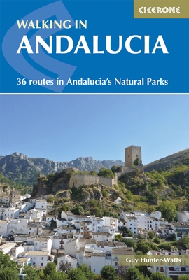 Walking in Andalucía is a 260 page full colour guide to some of the very best walks in southern Spain, taking the walker on 34 routes - all starting and most finishing in beautiful villages - in the Natural Parks of Grazalema, La Alpujarra, Cazorla, Los Alcornocales, Aracena, and La Axarquia. Many of the full and half day walks are virtually unknown even though they are a short drive from the Costa del Sol. Even though more and more people are beginning to walk Spain's southern sierras, most of the routes remain blissfully undiscovered. Guy says, 'If you decide to head for the hills with my guide you can be sure of two things: you will be walking through areas of great natural beauty and you will meet with other walkers.'
Buy a printed or eBook copy online direct from publishers Walking in Andalucia.
"Coastal walks in Andalucia" by Guy Hunter Watts
 45 great coastal walks close to Andalucia's Mediterranean and Atlantic coasts. Discover the best hiking trails close to Vejer, Caños de Meca, Conil, Tarifa, Bolonia, Gibraltar, Casares, Estepona, Marbella, Istán, Mijas, Benalmádena, Alhaurín, Cómpeta, Fuengirola, Nerja, Maro and Almuñecar. Talk to most people about the coast of Andalucía and they’ll picture the small swathe of seaboard that runs from Torremolinos to Estepona, the heartland of what is commonly sold as the Costa del Sol. First associations are of crowded beaches, busy coastal roads and blocks of holiday apartments. Few amongst them will conjure up visions of the mighty chain of mountains, the tail end of the Sierra Subbética, which rises up a few kilometres back from the sea. Nor do they tend to evoke the wilder beaches of the Costa de la Luz or the footpaths that run just a few metres from the Atlantic surf.
Buy a printed or eBook copy online direct from publishers Coastal Walks in Andalucia.
"The Andalucian coast to coast walk " by Guy Hunter Watts
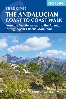 A stunning 21 day, 435 kilometre trail that links the Mediterranean with the Atlantic. The walk passes through six of Andalucia's Natural Parks and protected areas via its most beautiful mountain villages. Far more than a long walk, this on-foot odyssey can lead you to the heart of southern Spain's magnificent sierras and on a life-changing journey of discovery. One of the best things about the simple act of walking is the sense of reconnecting with Nature and the Big Wide World. We've been moving around on two feet for a very long time yet still, in the simple act of putting one foot in front of the next and moving across landscape, it seems that we reassert our identity. Day to day worries fall into insignificance, or rather true significance, when we get out into the mountains and walking is about a lot more than taking exercise.
Buy a printed or eBook copy online direct from publishers The Andalucian Coast-to-coast Walk.
"Walking the Mountains of Ronda and Grazalema" by Guy Hunter Watts
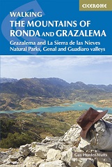 The dramatically situated town of Ronda can make a great base for a walking holiday in the mountains of Andalucía, as can any one of the picturesque 'pueblos blancos' (white villages) that nestle among the surrounding hills. This guidebook presents 32 mainly circular walks in the Ronda region, covering the town and its environs, the Natural Parks of La Sierra de Grazalema and La Sierra de las Nieves (both UNESCO biosphere reserves), and the Genal and Guadiaro Valleys. Clear route description is illustrated with mapping, and the route summary table and 'at a glance' information boxes make it easy to choose the right walk.
Buy a printed or eBook copy online direct from publishers Walking the Mountains of Ronda and Grazalema.