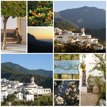
Genalguacil

Deserted villages of Genalguacil

Other than the outstanding beauty of the area, the mountainside is littered with sites from man's past. Probably the largest in the district was the village of Benestepar, which nearly survived the Morisco uprising, only to fade due to the economic pull of Casares and Genalguacil in the early 17th century.

History

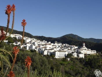
Genalguacil is the only village that takes its name from the River Genal, whose waters played such an important role in this valley's agricultural development under Moorish rule. The river's name originates from Guadigenal or "Waddi Genna", meaning the river of paradise.

Charco Azul

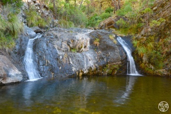
Charco Azul is a natural pool and waterfall in the Arroyo del Quejigo which is one of the small stream tributaries to the Rio Genal. It is an isolated location and on most visits you will be alone you enjoy a swim (with or without swimming costume) in the crystal clear pool. There are two small (three metre) waterfalls cascading down eather side of a rock butress.

River Genal

Where today's Estepona to Algatocin road (MA-536) crosses the Genal River by the Puente de San Juan, you can find a popular roadside restaurant called Venta de San Juan and two campsites (one of which is called Camping Genal).

Camping Genal

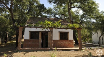
Camping Genal is located in deep in the Genal river valley between Jubrique and Algatocin on the MA-8305 road. A secluded area very quiet and great for kids to play safely outside. It is a superb location right beside the Genal river in a woodland location. Swimming is popular in the river in the summer months.

Sierra Bermeja mountain

The Sierra Bermeja mountain (1.449m) dominates the landscape behind Estepona. There are few places in the world where a mountain reaches this height so close to the sea (10km) You can drive to near the top in under an hour. Take the road (Carretera Genalguacil) (MA-8301)

Los Reales de Sierra Bermeja Natural Area

Located in the southwest part of Malaga province, the Sierra Bermeja is a mountain range with an average height of 1,000m (its highest point being 1,450m), covering 1,236ha. It is an area that has undergone major volcanic activity; the rocks are rich in the olivine mineral. Rainwater has oxidised the iron and magnesium present in the rocks and the iron oxide has coloured the rock reddish-ginger, a hue that gives the sierra its name.