Herrera - maps
Take me to Herrera Home
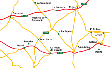
If you are considering visiting Herrera you may find our maps a useful tool, we currently provide two maps.
The first is a handcrafted map giving the location of Herrera with the corresponding local road network.
For the second, we have embedded a Google map which is centered on Herrera.
On Andalucia.com we use Google Maps service, you can view basic or custom maps of the 8 main provinces of Andalucia, its coasts and major villages. Click and drag maps to view adjacent sections immediately. View satellite images of your desired location that you can zoom and pan.