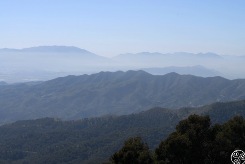
Barely a few kilometres north of Malaga city, the Montes de Malaga Natural Park |
|
Home | Accommodation | Fauna | Flora | Suggested routes | Walks
Montes de Malaga Natural Park
Barely a few kilometres north of Malaga city, the Montes de Malaga Natural Park is a region of dense pine forest. It covers a gently rolling area of 4,996ha crossed by small valleys and water courses, fast flowing in winter, and waterfalls. Due to its proximity to Malaga, it is a popular weekend destination for malagueños.
The park is dominated by Aleppo pines, which were planted in the Río Guadalmedina river basin by Malaga city council in a concerted reforestation campaign, from 1930 until 1950, in an attempt to prevent the disastrous flash floods that had plagued Malaga for centuries.
Deforestation of the original Mediterranean woodland began in the 15th century when the Catholic Monarchs took possession of Malaga and divided up the land. The new owners cut down the native trees and replaced them mainly with olive trees and grapevines. Major deforestation signalled the beginning of a succession of catastrophic floods in Malaga, the first recorded one being in 1544, and these continued until the early 20th century. With the creation of the Agujero reservoir and the series of reforestation programmes in the 1930s, there was considerably less flooding.
Until the phylloxera epidemic ravaged the area in the late 19th-century, viticulture was the main economic activity and the legacy of this can be seen today, in the lagar houses dotting the Montes de Malaga. A lagar was a house with its principal section dedicated to wine production. You can visit a former lagar, now converted into a museum: the Ecomuseo Lagar de Torrijos.
The park is rich in flora and fauna, with species of 400 plants, 90 birds, 27 mammals, 19 reptiles and eight amphibians being recorded here.
Its hills range from 80m to just over 1,000m above sea level.
The park is located in the river basin of the Río Guadalmedina, which flows to the west of the park. Tributaries of the Guadalmedina feed into it, running southwest, like the Arroyo de Don Ventura, the Cañada de Guijarrro and Arroyo de Humaina. In the northern part of the park are Arroyo de los Frailes, Arroyo de Chopares and Arroyo de las Vacas.
Access
The main entrance is at Fuente de la Reina, near the Parque de Torrijos, off the A345. This road leaves the north east of Malaga city and climbs steeply up the mountain with some hairpin bends. It then follows the eastern border of the park.
Alternately take the N331 Motorway north from Malaga in the direction of Antequera. This motorway follows the Guadalmedina Valley which forms the west border of the park. There is no access however from this side. At Casabermeja take the A355 east in the direction of Colmenar where you can take the A345 south along the eastern border of the park where there are a number of entrances.
Cities and villages nearby:
Casabermeja
Colmenar
Malaga city