Latest Pages

Latest pages

We are committed to updating our pages as regularly as possible, allocating over half of our editorial resources to this essential task, to ensure that you can always find the latest, most reliable information on popular topics and places.

Here is a list with the latest pages that have been updated or created. Most recent are at the top of the list.

Via Verde of the Lead Mines

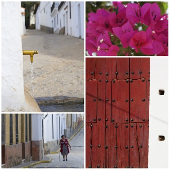
On this greenway, Minas del Plomo (Lead Mines), you can explore Linares’ mining past. The route is 11 kilometres long and runs between the town of Linares and Los Salidos de Linares mine. The route is accessible on foot, by bike and by horse. One section of the route, the part which runs from Ermita de la Virgen de Linarejos chapel to Restauración well.

Festivals in Alcudia de Monteagud

The Festivals in Alcudia de Monteagud are Cabalgata Reyes Magos, Día de Andalucía, Semana Santa, Fiesta de San Roque and Fiesta de Santa Lucía.

Granada Province - Órgiva-map

If you are considering visiting Órgiva you may find our maps a useful tool, we provide three maps, one of the region of Andalucia with Órgiva highlighted. The second handcrafted map gives the location of Órgiva with the corresponding local road network.

Bayarcal

Bayárcal is situated at an altitude of more than 1000m, making it the highest municipality in the province of Almería. This has gained the town a reputation for having, supposedly, the cleanest air in Europe, which pairs wonderfully with its natural and rustic beauty. It has around 320 inhabitants.

Getting there

Just west of the Costa del Sol in Cadiz provinceand a district of San Roque municipality. Sotogrande is about one and half hours drive from Málaga Airport, on the AP-7, and one and half hours from Jerez Airport and 45 minutes from Gibraltar airport.

History of Ohanes

The first evidence of human presence in the area dates back to the Neolithic era, in the so-called Culture of the Caves, where the Nieles and Almecena caves particularly stand out. Ceramic and imprint remains from the fifth millennium BC have been discovered. The Argar Culture and the progressive Iberian, Phoenician and Carthaginian hordes gave way to Roman domination.

Itineraries - Back Roads of Southern Spain

From detailed driving instructions to recommendations of what to see, what to eat and where to stay, Baird’s “Back Roads of Southern Spain” is the best accompaniment for car trips through Andalucia. Illustrated with excellent photos and maps, Baird covers many destinations in the region as well as creating themed excursions, so whatever you’re interested in; whether wine, seafood or poetry –there’s a car trip for you.

Garrucha

Garrucha has a rich history spanning fishing traditions and industrial mechanization, all of which can be observed throughout the town. It has around 8,800 inhabitants. The earliest reference to a settlement in Garrucha dates to 1327. The spot was fought over by nearby Vera and Mojácar until royal intervention offered the diplomatic solution of a tax on its port activities to be paid to the competing neighbouring towns.

Linares

Linares, land of bullfighters and musicians, offers visitors an interesting historical and artistic heritage. An important town in the north of Jaen with a population of 65.000. Linares was heavily involved in the mining and smelting of lead and the production of gunpowder.

Cádiz Province Museums

Museums in Cádiz province: Museo Municipal, Museo Tesoro Parroquial, Museo Monográfico de Baelo Claudia, Colección de Relojes and more.

Golf Courses in Ayamonte

In Ayamonte there are 3 fun, challenging and prestigious 18 hole golf courses that both novices and professionals can enjoy.

El Carpio

El Carpio sits on the banks of the Guadalquivir River, and is topped with a tower on a hill. The town has around 4500 inhabitants.

Hospital de los Venerables

Located in Barrio Santa Cruz, in a pretty square with orange trees, the 17th-century baroque hospital was built to care for elderly, impoverished and infirm priests. From 2027, it will be used as a gallery for religious art, and offers a peaceful haven in this area which is often thronged with visitors.

Freila

Freila is the smallest of the villages in the Altiplano region of Granada. At an altitude of 804 metres above sea level and with a population of just over 1,000 you can locate it in GPS zone 30S and the map reference is X:05 08 10 / Y:41 53 70. The municipality of Freila covers an area of approximately 74 m2.

Book your stay in Andalucia Now!