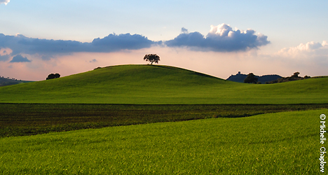
Fertile Plains by the large rivers
The Rio Guadalquivir lies just to the south of the Sierra Morena, and runs from the Sierra de Cazorla in Jaen, on the eastern side of Andalucia, to the town of Sanlucar de Barrameda, on the coast of Cadiz province.
This is Andalucía's longest river, flowing throughout the region - westward from Jaén province through Córdoba province and city, then south through Seville province and city before it enters the Atlantic ocean at Sanlúcar de Barrameda.
The valley of the Guadalquivir is the most fertile area in Andalucia, broadening out from east to west. From its lower end, a broad plain stretches west across Huelva province and southeast into Cádiz province. Near its mouth, the Guadalquivir splits into a marshy delta known as Las Marismas del Guadalquivir which includes the Parque Nacional de Doñana.
The Guadalquivir used to be navigable from the Atlantic as far upstream as Córdoba city, and is today still navigable up to Seville city, and its valley has always been the great artery of Andalucía. The plains rolling north and south from the river as far down as Seville are known as La Campiña. From around Córdoba downstream, the valley is referred to as the lower Guadalquivir basin.
Book your stay in Andalucia Now!