The white village of Arroyomolinos de Leon
Arroyomolinos de León
by Saskia Mier
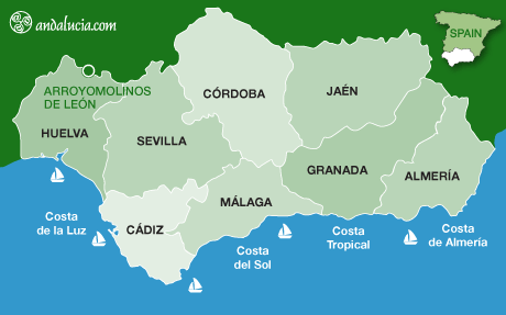
Arroyomolinos de León is at 609m above sea level, with a population of about 1000. It is located east of Cañaveral de León within the Natural Park of the Sierra de Aracena and Picos de Aroche on the border between Huelva province and Extremadura region, offering beautiful natural scenery. Like Cañaveral de León, Arroyomolinos was part of the Reino de León (Kingdom of Leon) whose southern part is now the autonomous community of Extremadura.
HISTORY
In the 13th century the Christians reconquered this area from the Moors and the Grand Maestre Pelayo Perez Correa, from the Order of Santiago, led the so-called Batalla de la Calera (battle), on Mount Tentudía. Years later, the place was repopulated by settlers from Leon who came down the Ruta de la Plata (Silver Path). The Encomienda Mayor de León (group of five villages: Fuentes de León, Segura de León, Calera de León, Cañaveral de León and Arroyomolinos de León) was formed.
Initially, Arroyomolinos de León belonged to Llerena in the south of Extremadura, but in 1274 the village was granted to the charter of Segura de León. In 1485, the Order of Santiago disappeared and Arroyomolinos became part of the Spanish monarchy until the 19th century.
During the reign of Isabel II, in the Territorial Reorganisations of 1833, it became part of the newly-created province of Huelva.
THINGS TO SEE
Ermita de Nuestra Señora de los Remedios
The most significant monument of the village is the Ermita de Nuestra Señora de los Remedios as it is the religious and folkloric centre of the pilgrimage which is held in May in honour of the patron saint (see below). The 17th century chapel has a popular Andalusian architectural style.
Iglesia Parroquial de Santiago el Mayor
Another important building in Arroyomolinos de León is the Iglesia Parroquial de Santiago el Mayor built in the 17th century.
Plaza de la Iglesia
Other places to visit are the church square, a charming plaza located in the centre of the village where you will find the Iglesia Parroquial de Santiago el Mayor. Surrounded by typical Andalusian townhouses the square is a focal point where all the villagers often meet, especially on summer evenings when the older generation get together outside the church and children play in the square.
Ancient Water Mills
A plentiful water supply in the Sierra encouraged the construction of many fountains, drinking troughs and watermills in Arroyomolinos de León. The watermills, constructed in the mid-15th century, were widely used until the mid-18th century. Documents show 200 mills scattered throughout the region, with over 30 located within Arroyomolinos de León. Currently there are 32 remains of mills on the banks of Arroyo Abismo-Morena and Arroyo Valdelamadera (better known as "La Gitana"), although some of them are in very poor condition.
Mirador El Paraje del Abismo
This viewing point is located 1.4kms north of Arroyomolinos de León. It can be reached easily from the church square Plaza de Iglesia. Continue up Calle de la Cruz to Calle Animas, bearing left at all crossroads, until you reach the mirador. By car it takes five minutes and walking takes 20 minutes. The coordinates are 38.037628, -6.419356.
El Mirador de la Sierra del Búho
This viewing point is located 6kms to the west of Arroyomolinos de León. It can be accessed from the village continuing on the A-434, turning left at Plaza de Constitucion, passing Bar Daigua. Continue straight following the road to the mirador. It is 20 minutes by car and 1 hour 25 minutes walking. The GPS coordinates are 38.017776, -6.468699.

Hotels near Arroyomolinos de León
Book Hotels near Arroyomolinos de León
GASTRONOMY
Arroyomolinos de León has similar gastronomy to many villages in the Sierra de Aracena. Cold pork products such as chorizo, salami and black pudding, as well as jamon (cured ham), are very popular. The signature dish is migas (fried breadcrumbs), however the village also offers delicious chickpea stews (cocido de garbanzos), bean pickle (escabeche de habichuelas), with sugared donuts, semolina (poleas) and quince jam (dulce de membrillo) for dessert. For delicious home-cooked food try El Mesón Rural Virgen de los Remedios on Plaza de Constitucion on the A-434.
HANDICRAFTS
The main craft in Arroyomolinos de León is crochet work. However, flamenco fashion has become very popular in Arroyomolinos and the village is home to various dressmakers specialising in very traditional dresses and horse-riding wear.
FESTIVALS
Romeria of the Virgen de los Remedios - The third Sunday of May is the pilgrimage in honour of the patron saint, the Virgen de los Remedios.
Fiesta de la Patrona Nuestra Señora de los Remedios - Celebrated in mid-August, this is the main festival for the village. This particular fiesta not only attracts all the inhabitants but also all those who have emigrated to other locations return for this celebration. As well as church services, the main event is the "toro de fuego" (bull of fire), a pyrotechnic object representing the bull which is carried through the village.
San Antonio de Padua - Traditionally on 13 June, the popular local fair is celebrated in honour of the patron saint, although in fact it lasts over 12, 13 and 14 June. A tradition known as 'las candelas' takes place at night, when young men and women jump over fires made of rosemary branches.
LOCATION
Arroyomolinos de León is located 184km from the city of Huelva - follow Avenida de Cadiz and the H-30, taking exit 10-A to Seville. From the H-31 continue along the E-1, taking exit 0-A towards Merida connecting with the A-66 and exiting onto N-630. Once on the A-434, continue on through the Cala crossing until Arroyomolinos de Leon.