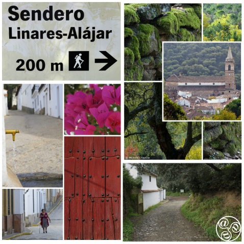
This is one of the loveliest walks in the Sierra de Aracena. |
|
THE WALK OF THE FORGOTTEN HAMLET
By Guy Hunter Watts
Distance: 11kms
Time Required: 4/4.5 hours
Rating: Medium
Map: IGN 1:50000 Aracena (917/10-37)
Water: in Linares at bars and spring @ 1 hr 30 mins
This is one of the loveliest walks in the Sierra de Aracena. It links two exceptionally pretty villages, Alejar and Linares de la Sierra. It is easy to follow and there's just one steep climb. The long sections of cobbled path, the abandoned hamlet of Los Madroñeros, and the peacefulness of the walk all contribute to make this a very favourite excursion. It's a walk to be savoured and is best combined with a leisurely picnic beneath one of the old oaks or olives which you pass by before reaching Linares de la Sierra or you could treat yourself to lunch at the excellent Restaurant Arrieros in the village centre. Be prepared for a fairly overgrown and rough section of path from Los Madroñeros up to Linares de la Sierra.
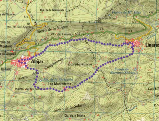 |
| Aracena,The Walk of the Forgotten Hamlet |
The Route
The walk begins in the main square of Alájar by a fountain with a statue of a girl with water pitcher. Leave the square on its south side via Calle San Bartolomé passing the Cajasol bank. When you reach a church turn left into Calle San Marcos. The road soon bears right, passes the small Plaza de Miguel Moya then drops down Calle Pintor Antonio Milla. At the end of the street you climb, bear right, then reach a sign for Sendero Los Madroñeros.
At this sign turn left and climb up a steep track that is at first concreted. Soon, descending between old stone walls, you reach a fork by a sign pointing left for Caracol de Los M, and right for Los Madroñeros. Take the right fork, continuing straight on along a lovely cobbled section of path. Views open out to the south and the small hamlet of Los Madroñeros comes into sight, up ahead in the distance. Soon you reach the first houses of the abandoned hamlet (30 mins).
Skirt around the southern side of the houses then cut bear left past the church to the village's central 'square' with a single mulberry tree at its midst. Its solitary form seems symbolic of the hamlet: it once had a population of 150 but is now disinhabited apart from the last Sunday in August when a pilgrimage takes place in honour of Nuestra Señora de la Salud Venerada. Go directly across this open area and at its top side cut right between two houses along up a path that runs on between ancient stone walls: there's faded P.R. waymarking. Crossing a (dry) stream the path winds on between evergreen and cork oaks then passes through a wire-and-post gate which is often left open (45 mins).
Beyond the gate the path climbs gently upwards. Passing by Cortijo Mailozana it descends then crosses the poplar-lined course of the Barranco de los Madroñeros. Careful! Immediately beyond the stream angle left and pass through a gap in a tumbledown wall. The path is narrow and overgrown as it passes behind a ruin, then cuts along just to the left of a wall. The wall at the side has collapsed in several places and you're obliged to cut right into the ruined farm's enclosure before cutting back left and continuing along the path. Soon you pass by a number of metal-fenced corrals in a field to your left then, still fairly overgrown, the path cuts hard left and then once more right. You pass by the gate of the leading to the farm of María Lozana . The path continues to contour round the hillside towards Linares, deeply eroded in parts, and rough underfoot.
Linares comes into sight as the path drops down an eroded gulley. You wind down on a final steep, cobbled section of path, cross a stream via a footbridge then follow a narrow path which runs up hill between two high walls then loops right and reaches the outskirts of the village which you enter past a large, chocolate-coloured building (currently being converted into holiday accommodation). Here you reach a map of the walk that you have just followed (1 hr 30 mins).
Here bear sharp left (unless you plan to visit the village in which case head straight on up into the village (W)) then immediately left again along a narrow path which runs between high walls with citrus groves to either side. You reach a wooden gate where, bearing right then left, you continue along the narrow path which now follows the course of a narrow water channel. Where the path ends you reach a cobbled track and another map, this one indicating the route that you'll now follow back to Alájar.
Turn left. Passing the village cemetery an oleander-filled stream soon runs to the left of your path. Continuing up along this track you pass a sign extolling the merits of the Cerdo Ibérico (free range pigs raised beneath the oaks) then a picnic site before beginning a long, steep ascent. As the countryside opens out you occasionally catch sight of the Linares to Alájar road which is up above you, to your right. The track narrows, becomes a path, and continues to climb up through the oaks and cistus, cobbled in parts. Eventually the path runs up to the Alájar-Linares road (2 hrs 30 mins).
Just before reaching the road turn left, climb a short flight of wooden posted steps, pass a bench, then descend a second flight of steps to a track. Head straight across the track to a marker post and a sign prohibiting the passage of quads and motorbikes. Here cut hard left and descend. After just 100m bear slightly left past a gate leading to a farm and continue your descent. The path at first hugs the left bank of the stream then crosses to its opposite bank.
The path reverts to track and continues descending. Having merged with another track it reaches the first houses of Alájar where it runs past another map of the walk you've just undertaken. Just past the sign the track meets with a road. Here bear left along Calle Rafael Montesinos. Bear left again just past a telephone booth and continue along Calle Virgen de la Salud. At the end of this street bear right to reach the church of San Marco then follow along its northern wall then turn right, descend past the Cajasol bank, to return to the main square of Alájar (3 hrs 15 mins).
Walking guide books by Guy Hunter Watts
Buy walking guide books by Guy Hunter Watts
"Walking in Andalucia" by Guy Hunter Watts
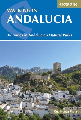 Walking in Andalucía is a 260 page full colour guide to some of the very best walks in southern Spain, taking the walker on 34 routes - all starting and most finishing in beautiful villages - in the Natural Parks of Grazalema, La Alpujarra, Cazorla, Los Alcornocales, Aracena, and La Axarquia. Many of the full and half day walks are virtually unknown even though they are a short drive from the Costa del Sol. Even though more and more people are beginning to walk Spain's southern sierras, most of the routes remain blissfully undiscovered. Guy says, 'If you decide to head for the hills with my guide you can be sure of two things: you will be walking through areas of great natural beauty and you will meet with other walkers.'
Buy a printed or eBook copy online direct from publishers Walking in Andalucia.
"The Andalucian coast to coast walk " by Guy Hunter Watts
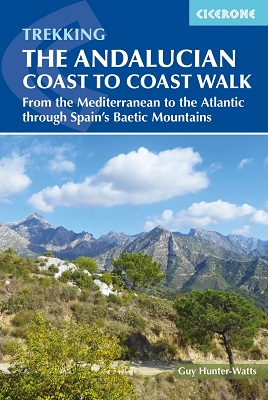 A stunning 21 day, 435 kilometre trail that links the Mediterranean with the Atlantic. The walk passes through six of Andalucia's Natural Parks and protected areas via its most beautiful mountain villages. Far more than a long walk, this on-foot odyssey can lead you to the heart of southern Spain's magnificent sierras and on a life-changing journey of discovery. One of the best things about the simple act of walking is the sense of reconnecting with Nature and the Big Wide World. We've been moving around on two feet for a very long time yet still, in the simple act of putting one foot in front of the next and moving across landscape, it seems that we reassert our identity. Day to day worries fall into insignificance, or rather true significance, when we get out into the mountains and walking is about a lot more than taking exercise.
Buy a printed or eBook copy online direct from publishers The Andalucian Coast-to-coast Walk.
"Walking the Mountains of Ronda and Grazalema" by Guy Hunter Watts
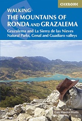 The dramatically situated town of Ronda can make a great base for a walking holiday in the mountains of Andalucía, as can any one of the picturesque 'pueblos blancos' (white villages) that nestle among the surrounding hills. This guidebook presents 32 mainly circular walks in the Ronda region, covering the town and its environs, the Natural Parks of La Sierra de Grazalema and La Sierra de las Nieves (both UNESCO biosphere reserves), and the Genal and Guadiaro Valleys. Clear route description is illustrated with mapping, and the route summary table and 'at a glance' information boxes make it easy to choose the right walk.
Buy a printed or eBook copy online direct from publishers Walking the Mountains of Ronda and Grazalema.