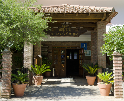
 |
| The walk begins at the entrance of the car park of El Refugio de Juanar. |
Los Cuchillos Walk
Distance: 8 kms
Time Required: 3/3.5 hrs
Rating: Easy/Medium
Total Height gain: 525m
Map(s): IGN 1:50000 Marbella 1065 (15-45)
Water: El Pozuelo spring @ 50 mins though it can run dry in summer
Overview
This shortish circular route takes you round the rocky massif that lies just to the north of the Refugio de Juanar with an optional 45 minute diversion to the top of the jagged ridge of Los Cuchillos, El Picacho de Castillejos (1238m). Even though I’ve graded the walk as Easy/Medium don’t imagine that this is in any way a dull route. At different stages of the walk you’ll be treated to massive views towards all four points of the compass and the terrain through which you’ll be passing feels wild and untamed: the chances of seeing ibex here are very good. The path up to the top of Los Cuchillos isn’t that clear but it’s a relatively short, easy climb with just a bit of hands on: provided you keep your wits about you it’s easy enough to plot a course. An added bonus is that the walk leads you through a stand of pinsapo pines (glossary), one of the Sierra de Ojén’s botanical jewels. I haven’t marked the Pozuelo spring with a water symbol because in summer it can slow to little more than a trickle. The path is slightly overgrown in parts so this is another walk where you’d be best to slip a pair of long trousers or gaiters into your day pack.
Getting to the beginning of the walk
From the A7 motorway exit for Marbella/Ojén on the A-355. Continue on towards Ojén via two roundabouts. Passing by two turnings off right towards the village cut left from the A-355 at a sign Refugio de Juanar along the MA-5300 which you follow all the way to the Refugio.
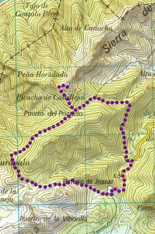
The Walk
Download the GPX files and instructions on how to load up files to BaseCamp
The walk begins at the entrance of the car park of Refugio de Juanar (WP01). From here descend 100m to a junction (WP02) then turn left along the MA5300. Descending gently, at a point where the metal barrier to your left has been clad with wood, you reach a signboard for Ruta del Pozuelo and a second ceramic sign Senda de José Lima (WP03). (10 mins) Here cut left and follow a path which zigzags down and crosses the Arroyo de Juanar (WP04) then climbs through low-growing Mediterranean scrub. Views open out towards the east and the north, and you shortly get your first sight of the Mediterranean before crossing a low col (WP05). (30 mins)
Book your stay in Andalucia Now!
Beyond this breach the path angles hard left, now adopting a more westerly course: you now have a ravine to your right. Descending the path cuts across a (dry) streambed (WP06) then begins to climb more steeply before crossing back to the stream’s left bank. Heading on up towards the jagged ridge of Los Cuchillos you reach the spring of El Pozuelo, marked by a rusting metal sign (WP07). Here the path swings left and resumes its ascent through a swathe of more mature pines and evergreen oaks. Reaching the top of the pass, El Puerto del Pozuelo, you arrive at a junction (WP08). (1 hr)
Here cut right (unless you don’t intend to climb the Cuchillos) and follow a narrow path up through low-growing scrub. Views open out to the west towards the Sierra Bermeja. Reaching a rock field on the western side of the Cuchillos the path bears slightly left, running more or less along the top of the treeline, more overgrown and loose in parts, heading straight towards a steep rock face. Some 70m before you reach this west-facing face angle right at a cairn (please add to it) (WP09) and continue up a steep, loose path: you’ll occasionally need to use your hands. The path zigzags indistinctly up: it’s a question of following your nose at this stage. Big vistas begin to open out towards the north and northeast. Angling slightly right head up to a solitary evergreen oak (WP10) beyond which is stand of pinsapos (FN). Here swing hard right then, heading almost due east, pick your way across the rocks - there’s no clear path but there are cairns - to reach the highest point of Los Cuchillos, El Picacho de Castillejos (1238m) (WP11). (1 hr 20 mins)
From here retrace your footsteps back to waypoint 8 (WP08) (1 hr 40 mins) where you should bear right in a southwesterly direction. Descending gently the path then runs once more uphill and cuts through a stand of mature pinsapo pines. Shortly a fence runs over to your left. As you round a bluff the fence cuts up left (WP12). Here angle right then arc hard round to the left. Descending through the last of the pinsapos you come to a flatter area. Here the path angles left (WP13) as the northern flank of La Concha comes into view. You pass through a more denuded area, evidence of a recent forest fire. Passing through a breach in the rocky hillside (WP14) the path becomes sandier as it zigzags steeply down before climbing to meet with a track (WP15) and a junction. Maintaining your course take the lower fork and follow the stony track as it loops back down towards El Refugio de Juanar. Cutting into the thick swathe of trees that surround the Refugio you pass a chain blocking vehicle access (sometimes left open) then angle right to reach the road. Angling left you return to the start point of the walk (WP01). (2 hrs 30 mins).
Day Hike in Marbella
 Day Hike in Marbella
Discover Andalusia’s beautiful nature, the hidden Hinterland, deep valleys, green hills and forests, flowers and wildlife, amazing rock formations, spectacular views over the southern coast and over to Africa. You learn about the history of the region as we walk through the white villages, visit Moorish castles, roman ruins, prehistorical caves... Only by walking you get to know the "real Andalusia". We walk in very small groups of maximum 8 walkers plus your personal guide, it is like walking in a friends group. At the end of the walk we generally have some tapas in a village bar on the square (not included) and enjoy watching the laid back life of the villagers. ![]()
Walking guide books by Guy Hunter Watts
Buy walking guide books by Guy Hunter Watts
"Walking in Andalucia" by Guy Hunter Watts
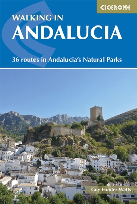 Walking in Andalucía is a 260 page full colour guide to some of the very best walks in southern Spain, taking the walker on 34 routes - all starting and most finishing in beautiful villages - in the Natural Parks of Grazalema, La Alpujarra, Cazorla, Los Alcornocales, Aracena, and La Axarquia. Many of the full and half day walks are virtually unknown even though they are a short drive from the Costa del Sol. Even though more and more people are beginning to walk Spain's southern sierras, most of the routes remain blissfully undiscovered. Guy says, 'If you decide to head for the hills with my guide you can be sure of two things: you will be walking through areas of great natural beauty and you will meet with other walkers.'
Buy a printed or eBook copy online direct from publishers Walking in Andalucia.
"The Andalucian coast to coast walk " by Guy Hunter Watts
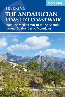 A stunning 21 day, 435 kilometre trail that links the Mediterranean with the Atlantic. The walk passes through six of Andalucia's Natural Parks and protected areas via its most beautiful mountain villages. Far more than a long walk, this on-foot odyssey can lead you to the heart of southern Spain's magnificent sierras and on a life-changing journey of discovery. One of the best things about the simple act of walking is the sense of reconnecting with Nature and the Big Wide World. We've been moving around on two feet for a very long time yet still, in the simple act of putting one foot in front of the next and moving across landscape, it seems that we reassert our identity. Day to day worries fall into insignificance, or rather true significance, when we get out into the mountains and walking is about a lot more than taking exercise.
Buy a printed or eBook copy online direct from publishers The Andalucian Coast-to-coast Walk.
"Walking the Mountains of Ronda and Grazalema" by Guy Hunter Watts
 The dramatically situated town of Ronda can make a great base for a walking holiday in the mountains of Andalucía, as can any one of the picturesque 'pueblos blancos' (white villages) that nestle among the surrounding hills. This guidebook presents 32 mainly circular walks in the Ronda region, covering the town and its environs, the Natural Parks of La Sierra de Grazalema and La Sierra de las Nieves (both UNESCO biosphere reserves), and the Genal and Guadiaro Valleys. Clear route description is illustrated with mapping, and the route summary table and 'at a glance' information boxes make it easy to choose the right walk.
Buy a printed or eBook copy online direct from publishers Walking the Mountains of Ronda and Grazalema.