Coast to Coast footpath's |
|

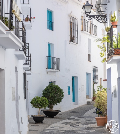
The beautiful cobbled streets of Frigiliana |
|
Coast to Coast footpath's starting point
From Maro to Frigiliana walk
Distance: 16 kms
Time Required: 5.5 hrs
Rating: Medium/Difficult
Total Height gain: 525m
Map(s): ING 1:50000 Motril 1055 (19-44) & Vélez-Málaga 1054 (18-44)
Water: waypoint 6 @ 1 hr
Overview
The Coast to Coast footpath's starting point is on the beautiful stretch of beach which lies just beneath Maro, one of the prettiest villages of the Costa del Sol, next to the Mediterranean Sea. After climbing up to the village past the old sugar cane factory the day begins in gentle mode as you head along a broad forestry track, cutting north from the Cueva de Nerja into the rumpled massif of the Sierra de Almijara. After passing the picnic area of El Pinarillo things take on a different tempo as the trail roller-coasters its way west towards Frigiliana across four deep gorges. It hardly seems possible, when you behold such wild mountain scenery, that you're only a few kilometers inland from the urban sprawl of the coast. This is a walk to be savoured so get going early and take a plenty of water. * The Nerja cave is well worth a detour if you've set out early in the day.
Cars delivered to your hotel or address in Frigiliana. All-inclusive prices, book your car online without cancellation fees!
The Walk
The walk begins on the beautiful Playa de Maro next to the lifeguard's chair. Take a deep breath: you have approximately 435 kms of mountain trail ahead of you (1).
Head west past the beach's shower and taps then cut right and climb a steep stone staircase. At the top bear left and head up a concrete road which passes a car park then arcs right, still climbing, before looping left and crossing a water course. The road climbs steeply between greenhouses and subtropical vegetation then levels as it runs towards the village and the ruined structure of El Ingenio de Maro (see Maro section ) (2).
Here turn left off the road and follow a rough path which cuts up past the Ingenio then climbs a flight of steps to reach the road. Here cut left along Calle Virgen de las Maravillas and follow the road as it arcs round Maro's southern flank with a balustraded walkway running to its left. Passing the Casa Romántica Hotel the road loops right then once more left past a No Entry sign. Bearing once more right you reach a junction opposite Bar La Entrada (3).
Turn left and follow the right side of the road past the Hogar y Centro Social Maro to a roundabout. Here take the second exit signposted Cueva de Nerja, pass beneath the motorway, then head on up past Hotel Al Andalus. The road arcs right before running up towards the black metal entrance gates to La Cueva de Nerja (4). (25 mins)
Don't go through the gate (unless you plan to visit the cave) but rather angle left past a sign for Área Recreativa El Pinarillo and a map of the G.R.242 (being waymarked as this book goes to press). After a few metres you pass a green barrier then head straight along a broad forestry track which climbs gradually upwards, ignoring any smaller tracks branching right or left: wooden posts with white arrows mark your way. You reach a fork where one sign points left for Área Recreativa El Pinarillo and another right for Sendero (5).
Here branch left. The track continues to climb and eventually arrives at El Pinarillo. Here the track divides again (6). Bearing left past a map of the park head straight through the picnic/camping area. You can replenish your water bottle 50m past the map at taps (W) next to a barbecue. At the far end of the picnic area, after passing a threshing circle, continue past a green barrier (7) then drop down a broad track and cross a (dry) riverbed.
20m beyond the riverbed the track divides. Take the narrower, left hand path which climbs steeply and shortly crosses the track you've just left. Head on up a deeply eroded path. You reach a broader track where you’ll see a marker post (8). Don’t turn right here (this fork leads to the Fuente del Esparto) but rather turn left along a broad track which ascends to the top of a pass where it passes a No Entry sign (9). Soaring views open out to the north and west. Continue along the track: angling hard right it runs up to a chain blocking vehicle access. (1 hr 45 mins)
Continue past the chain remembering that you'll be cutting left on to a narrow path in approximately 950m. You pass two marker posts to the left of the track then, at a point where the track cuts right, reach a third post and a large cairn (10). Here cut left on a narrow path which zigzags steeply down into the Chillar gorge: you'll see a few marker posts as you descend. The path drops down past a small ruin, crosses a water channel, then continues down to the riverbed (11). (2 hrs 15 mins)
Here bear right at a blue arrow on a rock along the river's east bank for 30m then cross to the opposite bank via stepping stones. Look for blue arrows. After running close to the river's west bank for about 50m (where there are rock pools where you can take a dip in the warmer months) the path angles left and begins to climb. You reach a point where the path divides by a marker post (12). Here cut left and continue to climb: the path is marked with green and blue painted dots. Eventually you reach the top of the second pass of the walk (13). (2 hrs 45 mins)
Beyond the pass the path, deeply eroded in parts, descends into the next valley, soon crossing a (dry) streambed (14). It then climbs for a short distance before descending again and crossing another stream where there's a cairn and a marker post (15). After crossing two more (dry) streambeds it climbs to the top of a third pass where views open out into the next valley (16). The vegetation becomes sparser, the result of a forest fire in the recent past. The path again descends and crosses another (dry) streambed (17) before climbing to the top of the fourth and final pass from where the Higuerón valley is visible to the west (18). The path runs along the spine of the ridge and, after passing a marker post where there are views both east and west, runs gently downhill just east of the ridge to reach a divide by a marker post (19). (3 hrs 35 mins)
Here cut right by a rock with blue waymarking on a narrow path which loops down through a stand of pines to the valley floor and a sign for Frigiliana/Fuente del Esparto (20). Here, swinging left and descending, you pass a white hut then a large water tank. The track leads on down the valley then loops across to the river's west bank towards a large green water pipe where it becomes concreted (21). Following the track steeply upwards through groves of avocado trees you reach the edge of the village, then the Unicaja bank and, just beyond, the Plaza del Ingenio and the Frigiliana taxi rank (22). (4 hrs 10 mins)
Walking guide books by Guy Hunter Watts
Buy walking guide books by Guy Hunter Watts
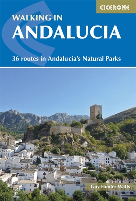
"Walking in Andalucia" by Guy Hunter Watts
 Walking in Andalucía is a 260 page full colour guide to some of the very best walks in southern Spain, taking the walker on 34 routes - all starting and most finishing in beautiful villages - in the Natural Parks of Grazalema, La Alpujarra, Cazorla, Los Alcornocales, Aracena, and La Axarquia. Many of the full and half day walks are virtually unknown even though they are a short drive from the Costa del Sol. Even though more and more people are beginning to walk Spain's southern sierras, most of the routes remain blissfully undiscovered. Guy says, 'If you decide to head for the hills with my guide you can be sure of two things: you will be walking through areas of great natural beauty and you will meet with other walkers.'
Buy a printed or eBook copy online direct from publishers Walking in Andalucia.
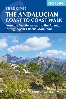
"The Andalucian coast to coast walk " by Guy Hunter Watts
 A stunning 21 day, 435 kilometre trail that links the Mediterranean with the Atlantic. The walk passes through six of Andalucia's Natural Parks and protected areas via its most beautiful mountain villages. Far more than a long walk, this on-foot odyssey can lead you to the heart of southern Spain's magnificent sierras and on a life-changing journey of discovery. One of the best things about the simple act of walking is the sense of reconnecting with Nature and the Big Wide World. We've been moving around on two feet for a very long time yet still, in the simple act of putting one foot in front of the next and moving across landscape, it seems that we reassert our identity. Day to day worries fall into insignificance, or rather true significance, when we get out into the mountains and walking is about a lot more than taking exercise.
Buy a printed or eBook copy online direct from publishers The Andalucian Coast-to-coast Walk.
"Walking the Mountains of Ronda and Grazalema" by Guy Hunter Watts
 The dramatically situated town of Ronda can make a great base for a walking holiday in the mountains of Andalucía, as can any one of the picturesque 'pueblos blancos' (white villages) that nestle among the surrounding hills. This guidebook presents 32 mainly circular walks in the Ronda region, covering the town and its environs, the Natural Parks of La Sierra de Grazalema and La Sierra de las Nieves (both UNESCO biosphere reserves), and the Genal and Guadiaro Valleys. Clear route description is illustrated with mapping, and the route summary table and 'at a glance' information boxes make it easy to choose the right walk.
Buy a printed or eBook copy online direct from publishers Walking the Mountains of Ronda and Grazalema.
